1. The context
Since the organization and operations of the Fire Brigade are structured on a territorial basis, we always start from the geographical boundaries of the territory of competence. Within these boundaries, the effectiveness and timeliness of rescue operations must be guaranteed.
Another fundamental element is the Fire Station present in the territory, they must be registered and geolocalised.
For a more in-depth analysis, it is recommended to record and geolocate all fires that have occurred over time.
At this point, with the street network of the area of interest available, it is possible to apply reachability algorithms that graphically indicate the guaranteed territorial coverage in the given time interval.
The case study uses the province of Milan as an example.
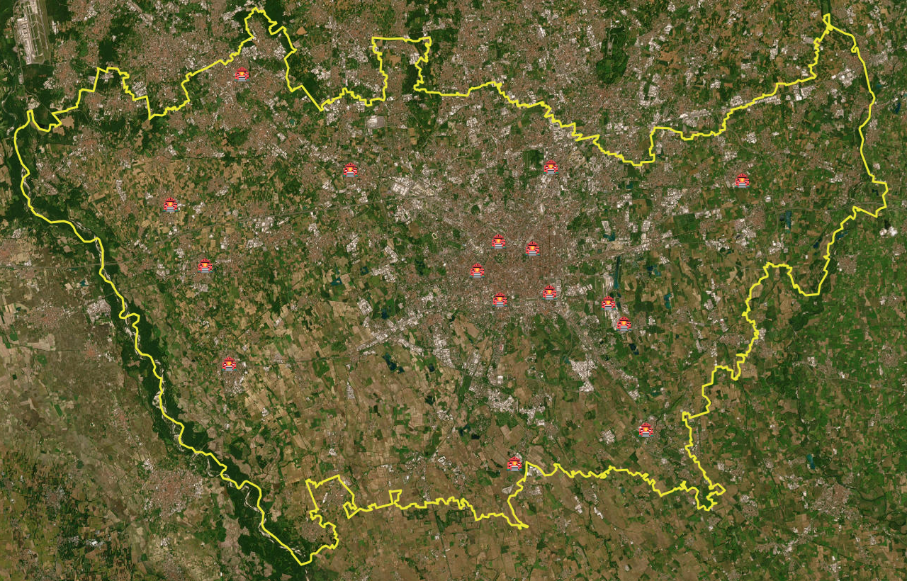
The Fire Stations are declared on the Fire Brigade portal.
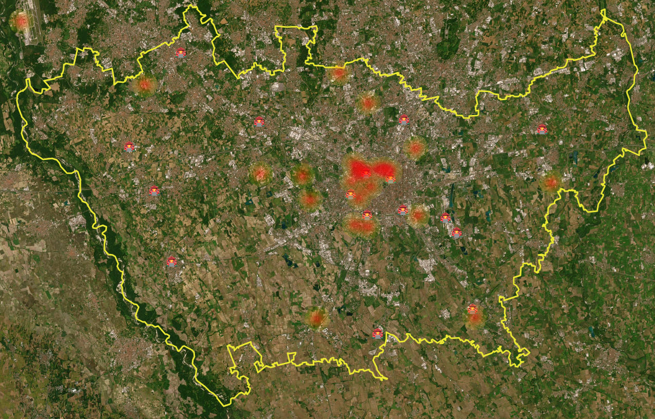
The fires recorded are just some of the fires that have occurred recently.
2. Territory and Fire Stations
As anticipated, the perimeter of the territory to be analyzed must be clear.
Furthermore, the Fire Stations from which rescue vehicles depart in the event of a fire or emergency must be precisely geolocated.
3. Fires
Adding fire history allows for more effective analysis.
4. Simulation of intervention times
At this point, all that remains is to use Iso4App to apply the reachability algorithms starting from the Fire Stations just defined. In the following image, this is indicated by:
- WHITE: streets reachable in 25 minutes
- PURPLE: streets reachable in 10 minutes
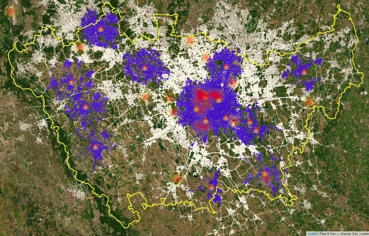
At 10 minutes, coverage doesn't seem optimal. Therefore, many areas can't be reached beyond that time.
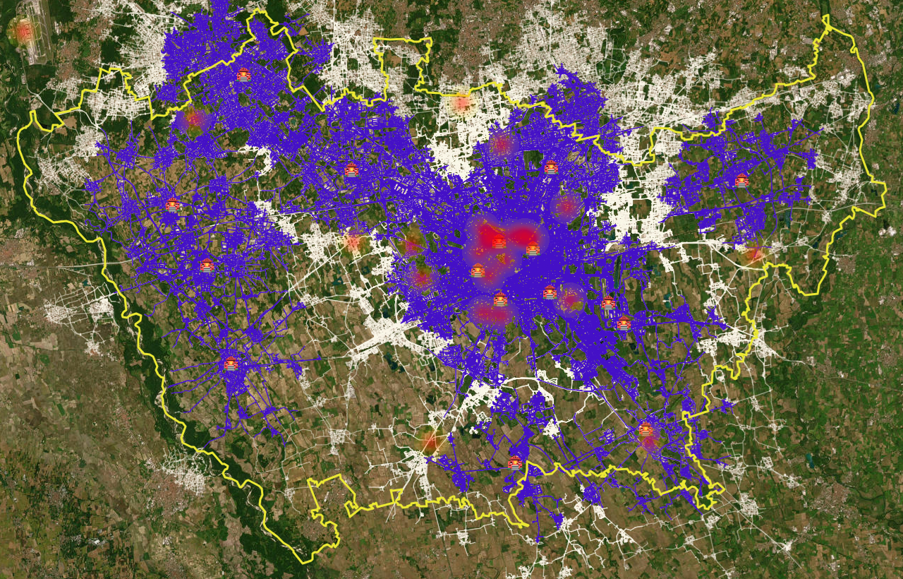
The following image calculates the 15-minute reachability, which appears to cover the relevant geographical area much better.
5. Conclusions
If the optimal intervention time is 10 minutes, the evidence shows that the territory is not adequately covered.
Further simulations are needed by adding Fire Stations or similar structures that improve accessibility..
Additional elements can be introduced into the simulations such as:
- firehose
- water tanks
- suction points
"Many European countries have a 6-minute response target, every extra minute could cost lives."